TracPlus Cloud 2.1.12: Introducing Markers, 3D Trails, and More
With each update, we aim to enhance your TracPlus experience, making it more intuitive, detailed, and versatile. This March, we're excited to introduce a range of new features and improvements that significantly expand your capabilities within the TracPlus Cloud platform. From the innovative Markers feature to the introduction of 3D Trails and more flexible units settings, these updates are designed to provide you with greater control and clarity over your operations.
New Feature Highlights:
TracPlus Labs: Markers - A New Way to Navigate and Organise:

- Manage Markers: Easily manage your organisation's markers through the new Manage / Markers page, providing a centralised view and control.
- Marker Display Options: Choose to display markers within the Labs section of map settings for a customised viewing experience.
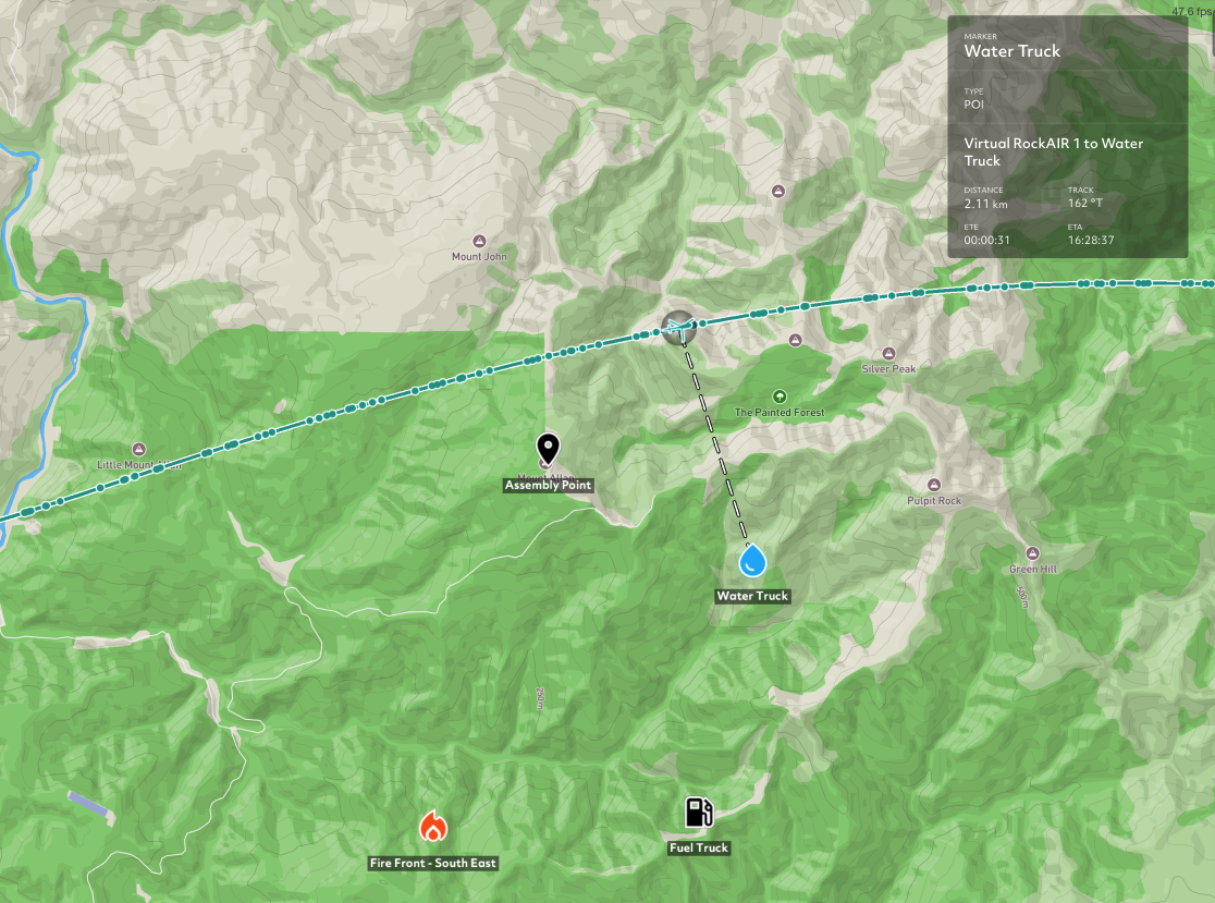
- Map Tool Creation: Directly create markers from the map with our new map tool, enhancing your ability to mark and remember critical locations.
- Interactive Map Overlay: Hover over any marker to display a map overlay, showing distance and ETE for the selected asset, bringing a new level of interaction and information to your map.
As this is an early release version through TracPlus Labs, we will constantly be making improvements to the feature. If you want to have more information listed in the marker such as supplementary information like phone numbers, gate codes, types of water site etc, talk to Todd from our product team at product@tracplus.com to work with us on what the next iteration should look like as we’re continuously enhancing this feature and need your input to make it better.
Learn more about Markers at our support knowledge base page
Enhanced Units Settings - Tailored to Your Preferences:

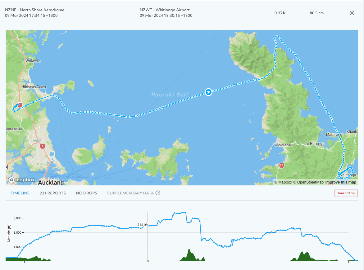
- Volume Units: Choose between litres (default) or US gallons for displaying volume-related data such as drops, pumps, and fills, aligning with your operational standards.
- Time Duration Units: Display time duration in hours:minutes:seconds (default) or switch to decimal hours for a streamlined view. Durations are intelligently displayed based on length, offering clarity and precision in time reporting.
-
Learn more about Markers at our support knowledge base page
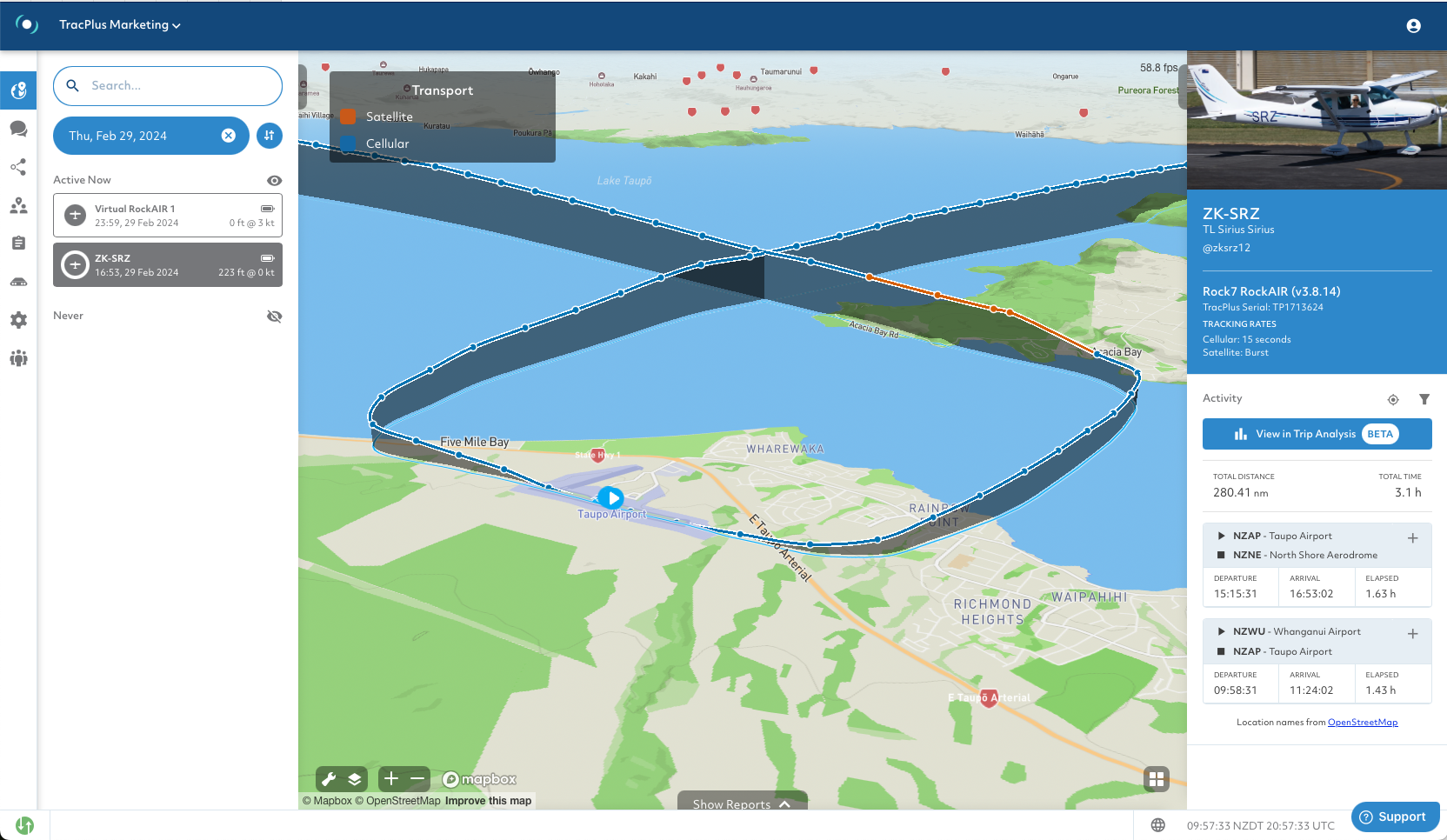
3D Trails - Elevate Your Tracking Perspective:

Embark on a three-dimensional journey with our 3D Trails feature, allowing you to view and review flight tracks in stunning 3D, complemented by our new terrain model. This enhancement brings your data to life, offering unparalleled insights into flight paths, terrain interaction, and operational planning.
Learn more about Markers at our support knowledge base page
Improvements:
- New Notification System: Our revamped notification system lets you view and manage event notification rules directly from the edit contact group page, ensuring you're always informed without clutter or confusion.
- Realistic Drop Rendering: Experience more accurate presentations of drops on the map, now rendered with straight lines to better reflect reality than previous spline curves.
Bug Fixes:
- We've squashed a bug that retained live reports into historic post-midnight, ensuring a fresh start each day.
- Fixed a presentation bug for trips without an end event, improving the accuracy and clarity of your trip reports.
Markers, 3D Trails, and More - Just the Beginning: These updates mark just the beginning of what's to come in TracPlus Cloud. We're continually working to bring you the features and enhancements you need to stay ahead. As always, your feedback is invaluable to us. If you have suggestions for future requests or want to see your existing markers from TracPlus Pro 3 integrated into the new Markers feature, reach out to us at product@tracplus.com.
Stay tuned for more updates as we continue to push the boundaries of what's possible in tracking technology. Your mission is our priority, and we're here to support you every step of the way.
